Scientific Expedition Supports Coastal and Marine Biodiversity Management on Teon, Nila, Serua Islands
Media Contacts
-
Adia Puja Pradana
Communications Specialist Ocean Program YKAN
Yayasan Konservasi Alam Nusantara
Email: adia.pradana@ykan.or.id
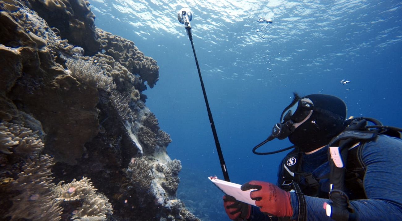
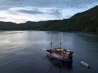
Central Maluku, April 30, 2025 - To encourage community-based management of coastal and marine biological resources and build a sustainable fisheries future in eastern Indonesia, especially in Maluku Province, Yayasan Konservasi Alam Nusantara (YKAN), together with the Maluku Province Marine and Fisheries Service (DKP), Pattimura University, the community, and other partners, carried out a scientific expedition from April 15-30, 2025 in Teon, Nila and Serua Islands (TNS), Central Maluku Regency.
The expedition includes comprehensive biophysical, biodiversity, socio-economic cultural, governance, and spatial mapping surveys, to collect comprehensive baseline data to support the sustainable management of community-based coastal and marine biological resources and small-scale fisheries.
“The Maluku Provincial Government strongly supports this expedition, as a commitment to protecting sustainable marine resources. We see that strengthening scientific data from the field is key in formulating policies that favor small-scale fishermen, without compromising the sustainability of coastal ecosystems,” said Erawan Asikin, Head of the Maluku Province Marine and Fisheries Service (DKP).
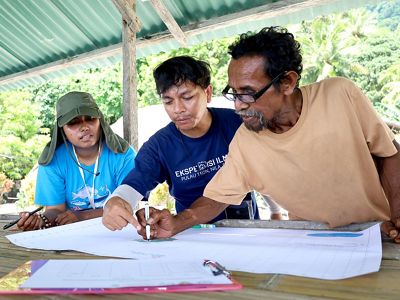
In its implementation, the expedition involved not only researchers and technicians, but also local officials and local communities who actively participated in the participatory mapping process, field data collection, and in-depth discussions on the utilization of water areas around Teon, Nila, and Serua Islands.
“The TNS community is honored to be part of this activity. The presence of the community from the beginning of the process is significant, because this is not just a matter of mapping and data collection, but also concerns our future as an island community,” said Ronald Wonmali, Sub-District Head of Teon, Nila, and Serua.
“The TNS community is honored to be part of this activity. The presence of the community from the beginning of the process is significant, because this is not just a matter of mapping and data collection, but also concerns our future as an island community,” said Ronald Wonmali, Sub-District Head of Teon, Nila, and Serua.
Through an inclusive scientific approach, the team conducted biophysical mapping of coral reef, seagrass, and mangrove habitats; surveys of biodiversity such as hammerhead sharks, birds, and herpetofauna; and water quality assessment and estimation of blue carbon storage. On the other hand, dialog with the community and the collection of socio-economic data opened up discussion on the condition of fishermen and traditional marine management practices.
“As academics, we consider this scientific expedition very important. Collaboration between scientific knowledge and locality is a key pillar in developing equitable and effective regional management strategies. We must ensure that science does not stand alone, but rather merges with social reality and the wisdom of coastal communities,” said Gino Valentino Limmon, Director of the Pattimura University Marine Science Development Center.
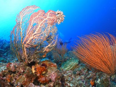
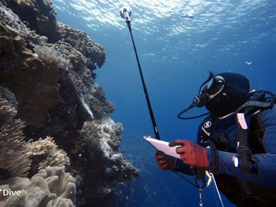
In this process, communities are involved in mapping marine areas and their potential as a source of livelihood, so that they can be protected from external pressures such as overfishing and industrial exploitation.
“The community is very supportive of this activity. As a coastal community, our lives depend on the potential of the sea. We hope that what results from this research can be the first step to protecting our sea. With cooperation like this, we feel more confident that we can protect our territory wisely and sustainably,” explained Islanti Lakotani, Head of Kokroman Hamlet, Nila Island.
The expedition is expected to generate important data that will serve as the foundation for coastal and marine management in the Teon, Nila, and Serua Islands that integrates biodiversity protection with community-based blue economy strategies, ensuring sustainable marine management in the TNS region.
Inclusive Fisheries Resource Management
This research is an important step in a fisheries resource management plan that includes a community TURF (Territorial Use Rights for Fishing) system of approximately 100,000 hectares. TURF is an area-based fisheries management system carried out by local fishing communities over a specific water area. In this process, YKAN uses a citizen science approach, a key element in which the community is actively involved in data collection, mapping, and monitoring of ecosystem conditions. As a result, scientific results are not only technically accurate but also socially and culturally relevant.
“The waters of Teon, Nila, and Serua Islands have great potential. That's why the TURF approach is relevant on all three islands. We promote people-centered conservation. This approach not only conserves natural resources but also strengthens community sovereignty and economic sustainability. TURF allows communities to become protectors of their seas, in a way that suits their culture, needs, and experiences,” explains Glaudy Perdanahardja, Senior Manager of Sustainable Fisheries at YKAN.
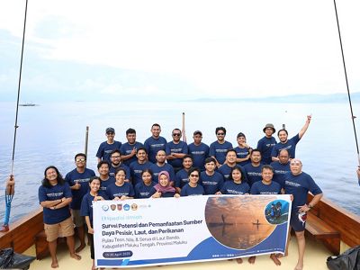
This approach emphasizes the principle of Free, Prior, and Informed Consent (FPIC), by ensuring local communities are actively involved in the planning and management of the area. It also opens up space for cross-party collaboration. “We believe that successful conservation must be rooted in the community. The data from this expedition will be the foundation for designing zoning that not only protects biodiversity but also promotes a fair and sustainable blue economy for local communities,” said Muhammad Ilman, YKAN's Marine Program Director.
This expedition reflects the collaborative spirit and scientific approach to building a healthy and equitable future for Indonesia's oceans. The results of this activity will inform decision-making for community-based management of conservation areas and support small-scale fisheries practices that are grounded in science and locality.
Yayasan Konservasi Alam Nusantara (YKAN) is a scientific-based non-profit organization that has been present in Indonesia since 2014. With the mission of protecting lands and waters as life support systems, we provide innovative solutions to realize the harmony of nature and humans through effective natural resource management, prioritizing a non-confrontational approach, and building a network of partnerships with all stakeholders for a sustainable Indonesia. For more information, visit ykan.or.id.
