Accurate Vessel Data is Vital for Managing Fisheries Management Areas
Since the number of fishing vessels in each area fluctuates over time, it is essential to regularly update data on fleet size and activity. This process, known as a frame survey, provides a foundation for sustainable fisheries management.


Indonesia is renowned for having one of the highest levels of marine biodiversity in the world. However, pressure on fisheries resources continues to mount due to intense fishing activity that is not always accompanied by sustainable management. To ensure a balance between the use and conservation of marine resources, accurate data is essential for informed decision-making. One important approach to this is the implementation of a baseline survey, commonly known as a frame survey.
The frame survey is an initial step in fisheries conservation efforts, aimed at mapping the status of fisheries within a given area. YKAN uses this survey to identify the types of fisheries in operation, the number and types of vessels involved, the fishing gear used, the locations of ports and landing sites, and the key fishery commodities being targeted.
YKAN also gathers essential information to support program planning and implementation, such as fishing trip patterns and the use of seasonal gear. The survey can also provide insights into the demographics of fishing communities, laying a crucial foundation for any comprehensive catch data collection that follows.
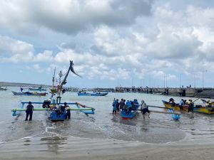
Ships and fishing gear
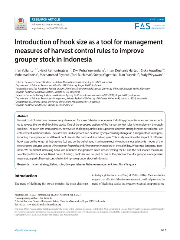
Data on vessels and fishing gear is critical for supporting sustainable fisheries management. YKAN’s surveys record vessel size, type of fishing gear, and fisher activities to inform more targeted policies.

Boat and Red Snapper: A fisherman lifts two red snapper showing their catch on a boat. © YKAN
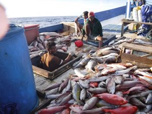
Fisherman and Catches: The fishermen are on the boat with their catch according to sustainable fishing methods. © YKAN
Pole and Line Fishing: Skipjack tuna (Katsuwonus pelamis) fishing activities using pole and line (Huhate) fishing gear in Bitung, North Sulawesi (WPP 715). © YKAN
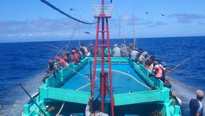
Bitung Black Marlin Catch: Captain Yan Nurcholis (Bitung) KM. Fishermen 2017-953 took a photo with the Black Setuhuk fish (Makaira indica). © YKAN
Survey data helps guide fisheries monitoring more effectively. It allows fishing vessels to be selected as representative samples, ensuring that the information collected accurately reflects the real conditions in each area. This data also helps assess the extent of fishing activity and whether it aligns with the availability of fish in the sea.
The survey also plays an important role in tracking changes in Indonesia’s fishing fleet over time. Fishing vessels are not static. Their numbers, sizes, and technologies evolve in response to shifting needs and conditions. That is why the survey must be conducted regularly to ensure the data remains accurate and relevant.
As a local non-government organization working in fisheries conservation since 2014, YKAN has carried out a range of survey activities across nearly all of Indonesia’s Fisheries Management Areas (WPP). Our primary focus has been on snapper-grouper fisheries, tuna, and small-scale coastal fisheries.

The data was initially gathered from government and non-government organizations, and then verified by observing fish landing activities, taking photos, and interviewing crew members, traders, and vessel owners. Verified vessels made up at least 5% of the total dataset, representing a variety of sizes and gear types.
By the end of 2019, more than 80% of Indonesia’s coastline had been surveyed, and the majority of fishing vessels had been recorded. However, vessel numbers within each Fisheries Management Area are dynamic. Boats move regions over time, so vessel survey information must be updated regularly to reflect these changes.