Media Contacts
-
Retno Dianing Sari
Content and Publication Specialist YKAN
Yayasan Konservasi Alam Nusantara
Email: Retno.dianingsari@ykan.or.id
The Provincial Government of North Kalimantan is trying to preserve and utilize the geological, cultural, and biological uniqueness in and around Mount Batu Benau as a geo-park. Mount Batu Benau is a karst landform that stretches from north to south along ± 15 km with an average width of 4 km and an area of 36 km2. Most of the karst area of Mount Batu Benau is located in the administrative area of Bulungan Regency, North Kalimantan Province, while the rest is in the Berau Regency, East Kalimantan Province. The latest research from the Karst Geography Study Group at Gadjah Mada University identified 11 points of geological diversity that have the potential to be used as geological heritage (geo-heritage).
The Gunung Batu Benau Geopark of North Kalimantan Province will become a new destination for tourism, education, and nature conservation. "Making it the status of an earth park is our dream for Batu-Benau," said the Head of the North Kalimantan Provincial Economic Bureau Rohadi in the event of a Grouped Discussion Group and Field Visit "Exploring the Potential of Earth Heritage in Bulungan Regency for the Development of the Gunung Batu Benau Geopark" on Friday, March 17, 2023. Participants who attended represented regional apparatus organizations related to the Mount Batu Benau Earth Park proposal. After the discussion, participants will visit and stay overnight with the Punan Batu indigenous people who inhabit the karst area of Mount Batu Benau.

Some efforts have been made to make geological heritage a prerequisite for proposing the development of a geopark. In addition, efforts are being made to form a team offering the development of a geopark and, of course, today's workshop, which aims to share information, inventory research results, socialize the progress of the proposed earth park, and field visits to several potential geological heritages around the Mount Batu Benau area. "We hope that the participating parties can see firsthand potential geo-site locations for geopark development in Bulungan," said Rohadi.
Making a site a Geopark is the right step to align goals and missions, both ecological and economical. This evidence can be seen in the Gunung Sewu Geopark, which spans three provinces, namely Central Java, East Java, and Yogyakarta. "There has been an increase in tourist visits and, of course, regional income after the establishment of the status of an earth park," said Member of the Expert Council of the Indonesian Geopark National Committee Budi Martono, who was also present as a speaker at the workshop.
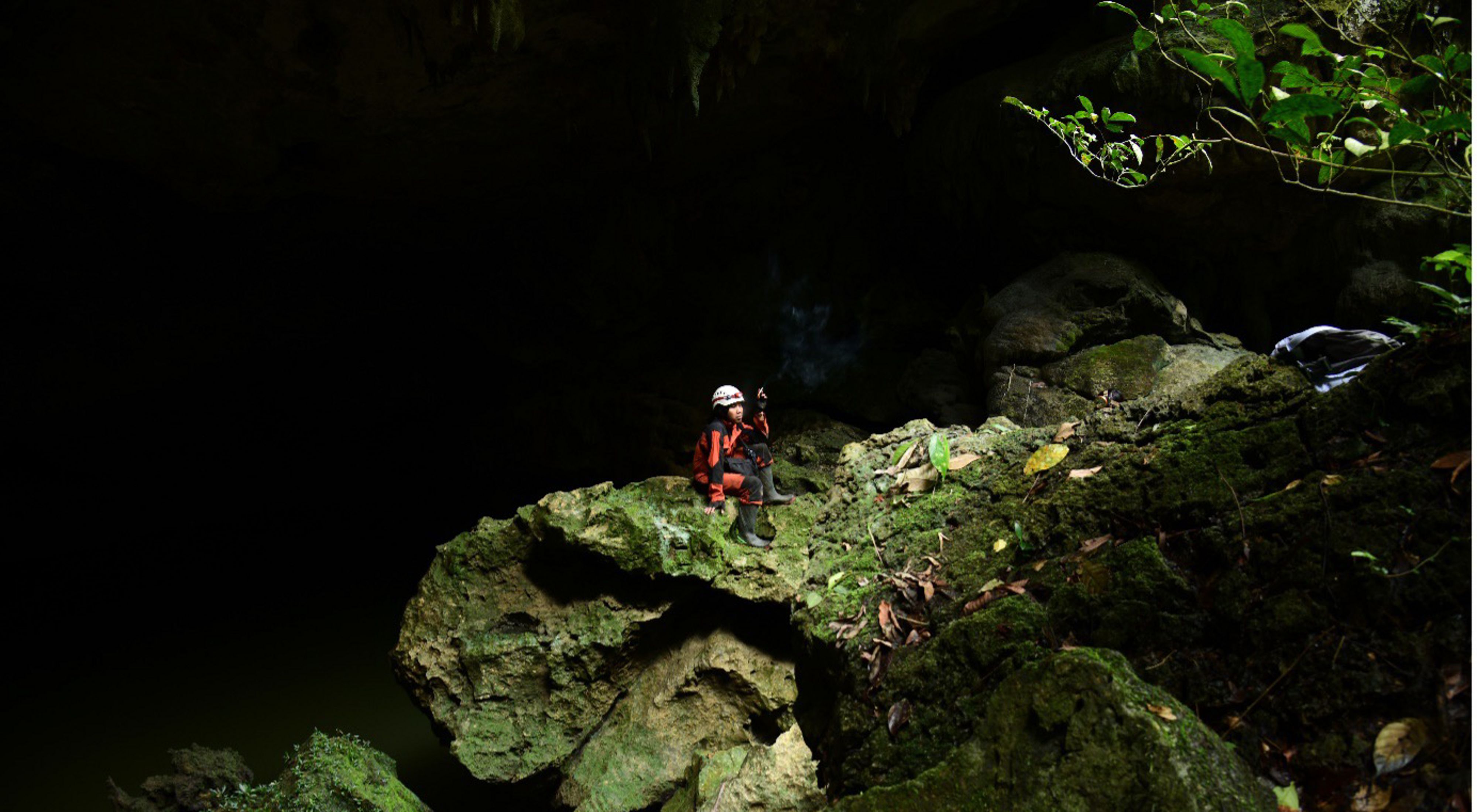
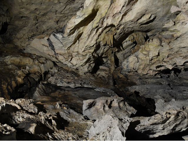
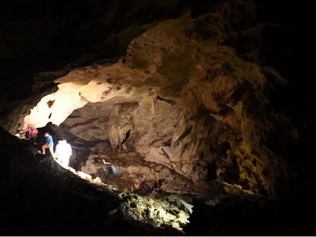
The opportunities and potential of Mount Sewu are possible for Mount Batu Benau to enjoy. The research results of the Karst Study Group, Faculty of Geography, Gadjah Mada University (UGM), in collaboration with Yayasan Konservasi Alam Nusantara (YKAN), show some potential. "At least we have discovered a geological potential with the discovery of 35 kinds of caves, in which there are large caves with long underground rivers, cave formations that vary from the shape of long tunnels and vertical shapes/wells," said the Head of the UGM Karst Study Group Professor Eko Haryono on the same occasion.
Professor Eko also added that there is a potential for cultural diversity, namely in the Punan Batu Indigenous community, which, based on the results of research by the Eijkman Institute, has unique genetics and culture. They make caves as burrows for habitation, still adopting a hunting and gathering lifestyle that is very dependent on the existence of the forest. Lastly is the potential for biodiversity.
"Until now, there has been no comprehensive study of biodiversity and culture in the context of developing a Geopark," said YKAN Senior Manager for Provincial Government Niel Makinuddin on a separate occasion. Developing a geopark requires a connection between geological, cultural, and biological heritage, referred to as the earth's heritage.
The existence of the Punan Batu people and their good forest cover is an indication of the earth's potential heritage. Niel said that this workshop was one of the steps taken by the parties to develop an earth garden in North Kalimantan. As the youngest province on the island of Kalimantan, North Kalimantan hopes to realize the slogan "BENUANTA," the provincial motto that means that our territory must be developed and maintained for the welfare of the people.
Maros-Pangkep Geopark Education Manager Ilham Alimudin said he supports the proposal for Mount Batu Benau as a geopark. "We want to give a message that Batu Benau is not alone in this process," he said, who was present as one of the speakers. Learning from management in Maros-Pangkep, developing a geopark is not just a matter of tourism. "We manage around 31 geo-sites representing mountains, karsts, and islands. We involve many parties to make this park a common property," said Ilham. Who also serves as a lecturer in geological engineering at Hasanuddin University, noted that a geopark is a place for education and community empowerment.

National Geopark Development Strategic Coordinator, National Development Planning Agency (Bappenas) Togu Pardede said that the wealth of Mount Batu Benau is complete. "Geoparks must contain diversification, not just geology, but also culture," he said, who was also present as a speaker. So visiting an earth park is like seeing the melodies of the earth or the sound of the earth, not only karst but also unique biodiversity and culture. The Ministry of Tourism and Creative Economy has issued Ministerial Regulation No. 2 of 2020 concerning Technical Guidelines for Geopark Development as a Tourist Destination. The government is targeting 12 earth parks by 2024.
Yayasan Konservasi Alam Nusantara (YKAN) is a scientific-based non-profit organization that has been present in Indonesia since 2014. With the mission of protecting lands and waters as life support systems, we provide innovative solutions to realize the harmony of nature and humans through effective natural resource management, prioritizing a non-confrontational approach, and building a network of partnerships with all stakeholders for a sustainable Indonesia. For more information, visit ykan.or.id.